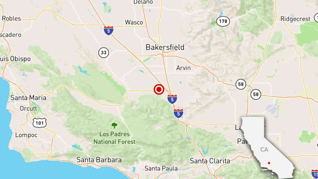
An earthquake with a magnitude of 4.1 hit California’s Central Valley, causing shaking in Bakersfield. The epicenter was located on farmland about 19 miles southwest of the city and 16 miles northwest of the northern edge of the Grapevine section of the 5 Freeway. This area marks the end of the San Joaquin Valley at the base of the Tehachapi Mountains. While the shaking was weak in Bakersfield, it may have also been felt in neighboring areas like Lebec and Frazier Park, on the border of Los Angeles and Kern counties. The earthquake took place at 3:31 p.m.
This region has a history of destructive earthquakes. In 1952, a magnitude 7.5 quake struck about 12 miles southeast of where Monday’s earthquake occurred. The 1952 earthquake brought intense shaking to Bakersfield, resulting in 12 deaths and the collapse of several buildings, especially in the town of Tehachapi. Damage was also reported in Bakersfield and Arvin. The impact of the 1952 earthquake was felt across the state, causing swimming pools to splash in Los Angeles and water in pressure tanks on buildings in San Francisco. Even San Diego experienced building damage. The estimated property damage back then was $60 million, which is equivalent to about $690 million in today’s dollars.
Recent days have seen increased seismic activity in Southern California. Just on Monday morning, a magnitude 2.9 earthquake struck underneath Los Angeles’ Eastside. This was the third earthquake to hit the El Sereno neighborhood this month. The day before, a magnitude 2.5 earthquake occurred in the Yorba Linda area.
These events serve as a reminder of the earthquake risks that Californians face. It’s important for residents to be prepared and have emergency plans in place. Earthquakes can strike without warning, and being ready can make a significant difference in ensuring safety and minimizing damage. Stay informed about the latest earthquake updates and follow safety guidelines to protect yourself and your loved ones.